 |
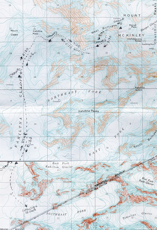
| The dashed line drawn on the topographic map above shows our route to 17,200'. As we made progress, I had penciled in the camps small filled triangles, labeling each camp CAMP#1" through CAMP#5. After our first ascent of each leg (remember we actually climbed each leg to CAMP#5 twice), I recorded our ascent and decent times. Our the times were as follows: |
Camp#
Ascent
Descent |